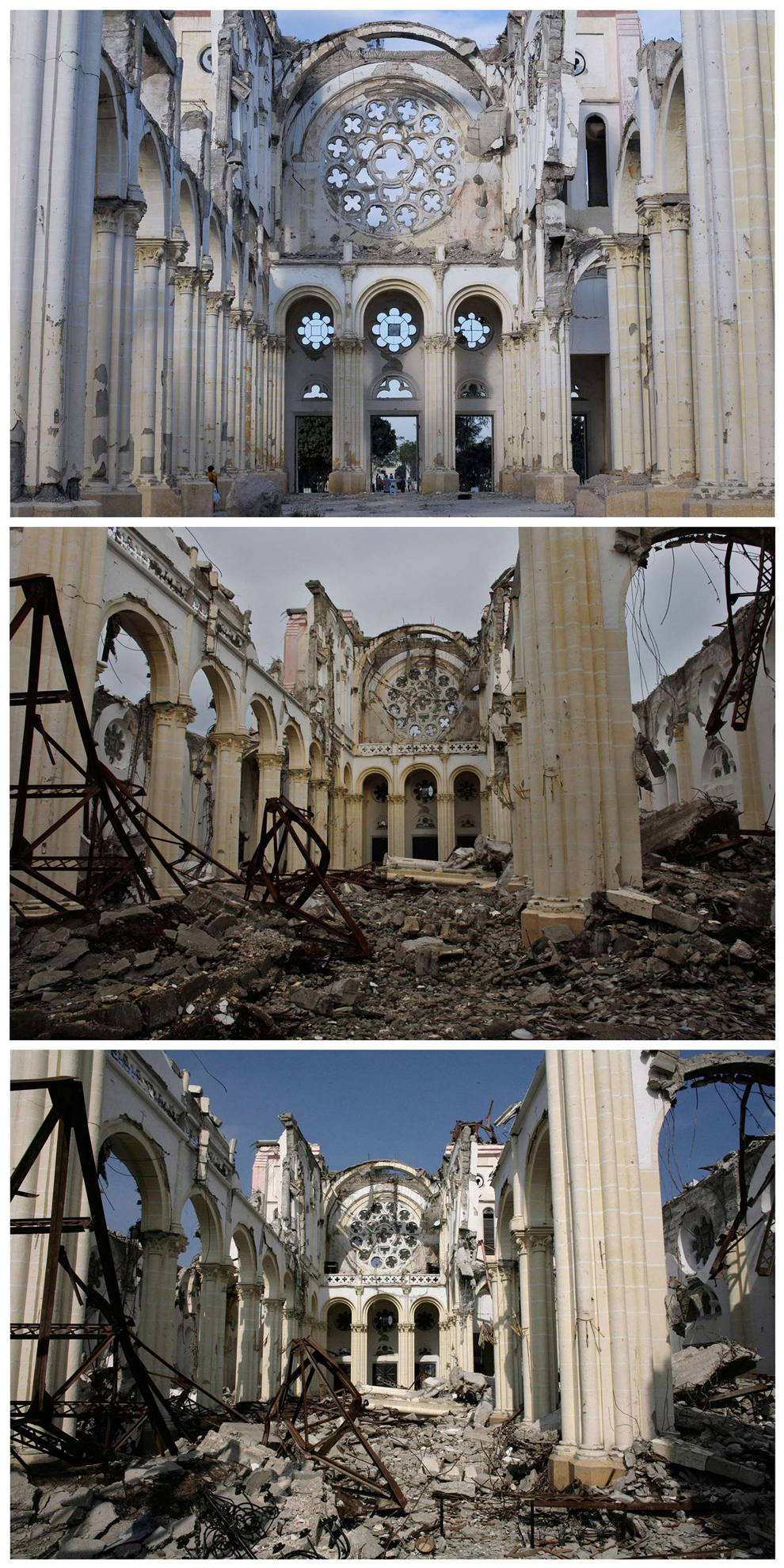
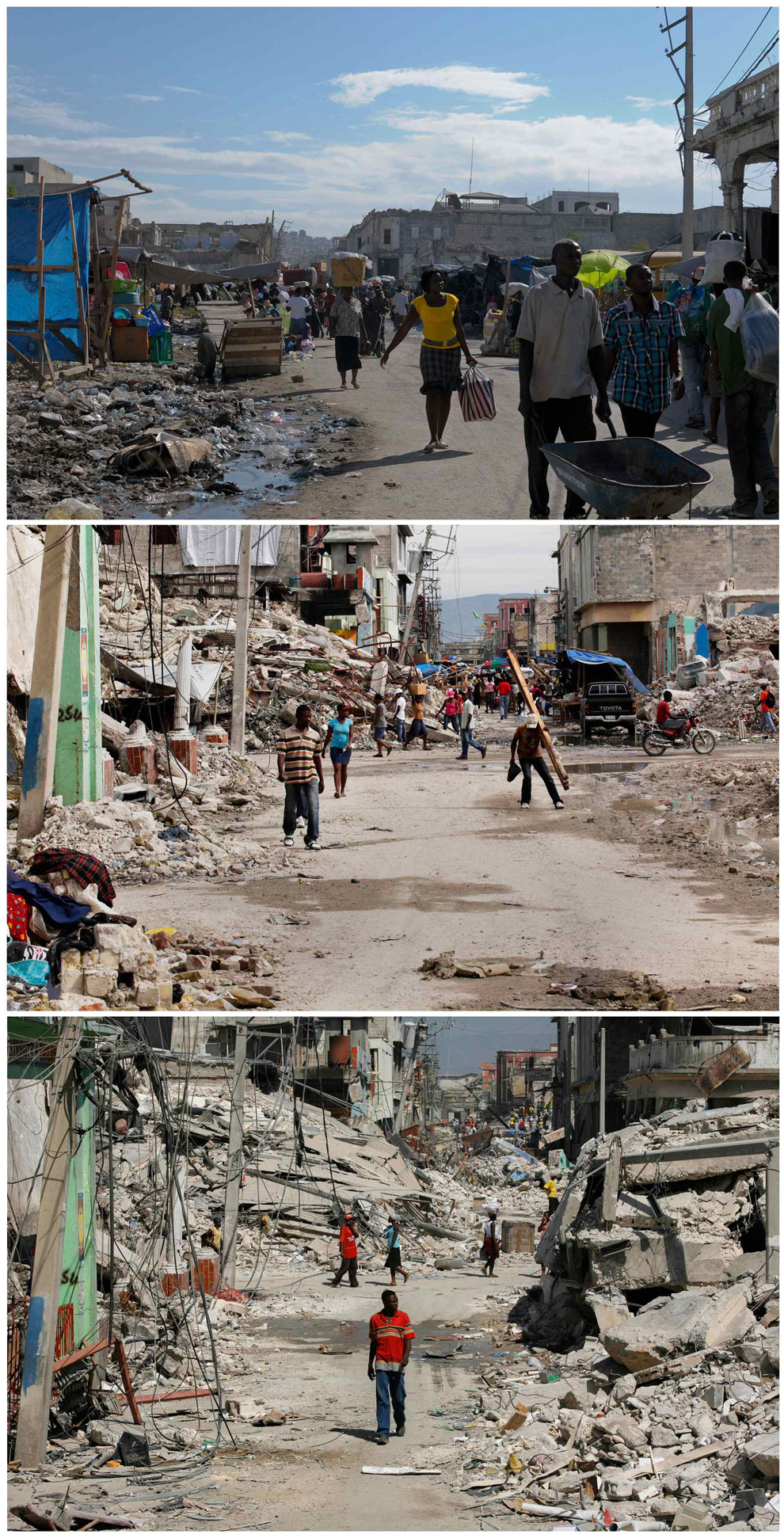
Here are a series of photos taken in the same place immediately after the earthquake, 8 months later and then 2 years after:
The most obvious reason for the slow recovery, is that Haiti is a developing country, the lack of immediate funds, and the various controversies around aid (here is an excellent overview from the Guardian), there are also ongoing hazards. Hurricane Tomas in 2010, and Emily in 2011, brought intense rains to a region plagued by long term refugee camps. In the ongoing effort to cook and heat their homes, many of the slopes around the Haitian camps have been deforested in order to supply fuelwood, enhancing the risk of slope failures and landslides. (National Geographic article here, some background from the Red Cross here) and a video of the landslides:
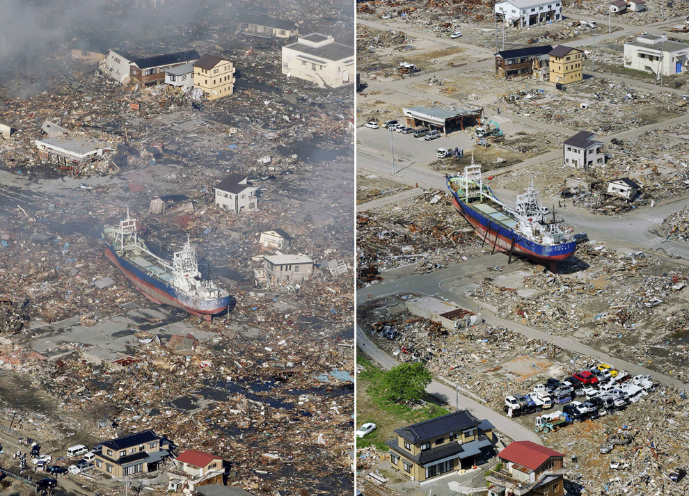
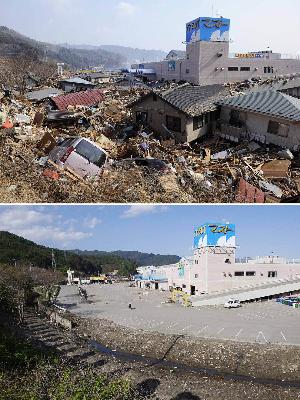
These photos are some comparisons to Japan, this earthquake was 700 times more powerful than Haiti, yet the world has watched in awe, as all except the regions around the crippled Fukushima plant have been cleared and repaired rapidly, this picture shows the repairs made 6 days after the quake:
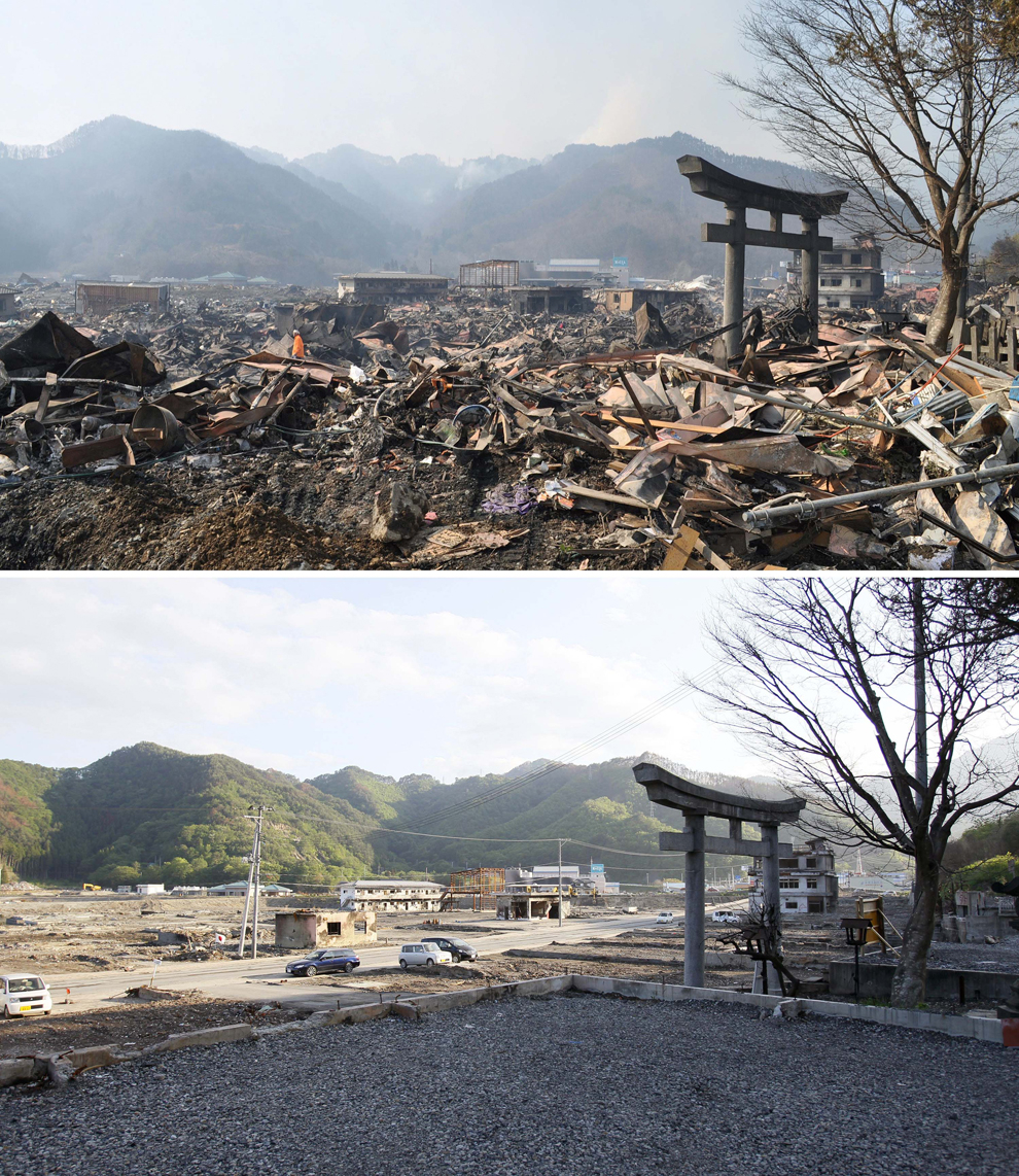
Here are a series of before and after shots, taken in June, only three months after the quake:
The frequency of the hazard was probably key, the last earthquake in Haiti, the previous earthquake was described as follows:
The earthquake of May 7, 1842, however, was the worst recorded in Haiti before this week’s catastrophic quake. It hit near Cap Haitien, a city of ten thousand inhabitants on the north coast of Haiti. Approximately half of the population died. Waves dashed against buildings along the quay. In the neighboring village of Port de Paix the sea withdrew 60 meters, only to come back to bury the city under four or five meters of water.This long gap in significant events means that modern day Haitians, did not have a living memory of earthquakes, and in a country where the education system was not well established, and hazard management was not part of the active curriculum, there was little awareness of the risk, and building codes had not been followed, leading to such wide spread collapse. With the added issue of there being only one working seismometer in the country, that at the time had not been turned on, meant there was no warning, or monitoring in place, as opposed to Japan, where there is significant funding for prediction, and the quakes are regular.
Christchurch:
Christchurch 2011, was an anomaly, and is a case study to use to illustrate the point that even a developed country, well used to earthquakes, with an integrated hazard management system, hazard resisitant design and a range of recovery practises in place, can suffer a devastating earthquake. In part, this was due to the quake itself, it was shallow, and close to the surface (5km depth). Another key factor was the nature of the substrate, the soft alluvial sediments meant that liquefaction was common, and affected up to 60% of Christchurch. Having suffered another, larger quake in the September before, this quake further weakened damaged buildings, and has caused a migration of people away from the region.
This series of before and after shots, from the week of the earthquake, to a year after, shows how slow recovery has been, and in part this is due to the high volume of significant aftershocks since last February.
So, the key differences are certainly development, money of course helps, the amount of aid received and the size of the quake, but there will always be other factors that create significant disasters from low Richter quakes, and those countries who can recover quickly from mega quakes.


